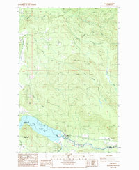
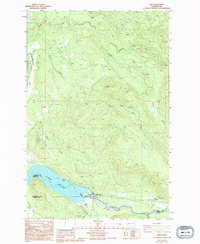
1987 Map of Elbe
USGS Topo · Published 1987About this map
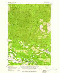
Elbe sits at a strategic junction in the south-central Washington Cascades, where the Nisqually River meets the eastern reaches of Alder Lake. This 1987 survey documents a landscape defined by its river systems and industrial footprints, showing the confluence of the Mashel River and Little Mashel River to the north. The presence of numerous Borrow Pits and Gravel Pits throughout the quadrangle suggests the importance of local material extraction for the region's infrastructure. To the east, Park Junction marks another transit point near the river's edge, while Dobbs Mountain rises as a prominent landmark in the center of the sheet. The map also traces various 4wd routes and local trails that snake through the timbered sections between Pleasant Valley and the lakefront Picnic Areas, offering a look at the area's recreational and working topography before further modern development.
Find a feature on this map
23 named features on this map. Tap any name to fly to it.
Don’t see what you’re looking for? This feature index may not catch every label — zoom into the map to look around manually.
Map Details
Editions of this 1987 Elbe Map
2 editions found
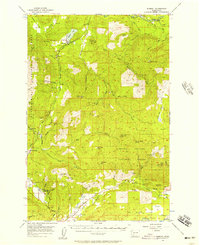
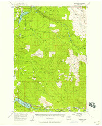
Other maps of this area

1937 · Eatonville
USGS Topo · 1:125,000

1941 · Tanwax Lake
USGS Topo · 1:62,500

1944 · Ohop Valley
USGS Topo · 1:62,500

1949 · Ohop Valley
USGS Topo · 1:62,500

1953 · Hoquiam
USGS Topo · 1:250,000
1956 · Mineral
USGS Topo · 1:62,500
1956 · Kapowsin
USGS Topo · 1:62,500

1957 · Hoquiam
USGS Topo · 1:250,000
1957 · Morton
USGS Topo · 1:62,500

1958 · Hoquiam
USGS Topo · 1:250,000