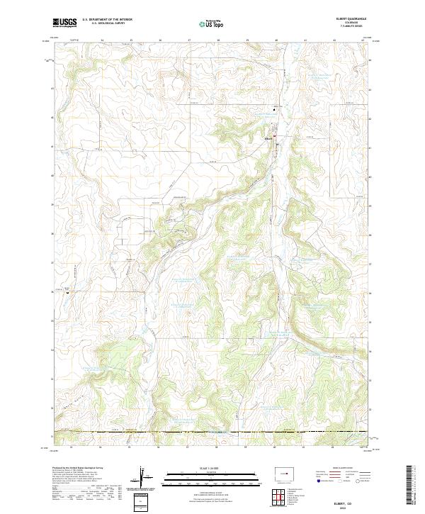
2022 Map of Elbert
USGS Topo · Published 2022About this map
The small unincorporated community of Elbert sits at the junction of Main St and Eccles St, serving as a central point in this prairie landscape. The area is defined by a complex drainage network where Kiowa Creek and Running Creek wind through the terrain. A notable feature of this modern survey is the extensive water management system, illustrated by numerous numbered reservoirs such as Kiowa Cr Watershed 1-W-20 Reservoir and Kiowa Cr Watershed 2-K-10 Reservoir.
Find a feature on this map
64 named features on this map. Tap any name to fly to it.
Don’t see what you’re looking for? This feature index may not catch every label — zoom into the map to look around manually.
Map Details
Editions of this 2022 Elbert Map
This is the sole edition of this map. No revisions or reprints were ever made.
Other maps of this area

1894 · Castle Rock
USGS Topo · 1:125,000

1913 · Castle Rock
USGS Topo · 1:125,000

1939 · Elizabeth
USGS Topo · 1:62,500

1940 · Elbert
USGS Topo · 1:62,500

1944 · Elbert
USGS Topo · 1:62,500

1945 · Elizabeth
USGS Topo · 1:62,500

1953 · Denver
USGS Topo · 1:250,000

1954 · Cherry Valley School
USGS Topo · 1:24,000
1954 · Black Forest
USGS Topo · 1:24,000
1954 · Eastonville
USGS Topo · 1:24,000