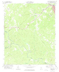
1973 Map of Elberton West
USGS Topo · Published 1975About this map
Granite quarrying and river junctions define this section of Georgia, where the Broad River meets its South Fork along the meeting point of Elbert, Madison, and Oglethorpe counties. The landscape is marked by numerous quarries, particularly around the rail lines that served the industry. The Seaboard Coast Line railroad cuts through the center of the sheet, connecting the town of Elberton with smaller rural outposts like Oglesby and Ethridge. This network of rail and stone extraction provided the economic backbone of the region during the early 1970s.
Find a feature on this map
27 named features on this map. Tap any name to fly to it.
Don’t see what you’re looking for? This feature index may not catch every label — zoom into the map to look around manually.
Map Details
Editions of this 1973 Elberton West Map
2 editions found
Other maps of this area

1891 · Carnesville
USGS Topo · 1:125,000

1893 · Elberton
USGS Topo · 1:125,000

1906 · Crawfordville
USGS Topo · 1:125,000

1953 · Athens
USGS Topo · 1:250,000

1954 · Greenville
USGS Topo · 1:250,000

1958 · Greenville
USGS Topo · 1:250,000

1958 · Athens
USGS Topo · 1:250,000

1958 · Danielsville
USGS Topo · 1:62,500

1958 · Elberton
USGS Topo · 1:62,500

1959 · Athens
USGS Topo · 1:250,000