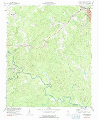
1973 Map of Elberton West
USGS Topo · Published 1991About this map
The granite quarrying industry of Northeast Georgia defines the landscape west of Elberton in this early 1970s survey. Scores of individual quarries and larger quarry complexes are clustered along the Seaboard Coast Line railroad, particularly near the small settlements of Ethridge and Oglesby. These rail-side operations highlight the region's primary economic driver, with industrial infrastructure like the substation and water tank supporting the heavy extraction and transport of stone.
Find a feature on this map
25 named features on this map. Tap any name to fly to it.
Don’t see what you’re looking for? This feature index may not catch every label — zoom into the map to look around manually.
Map Details
Editions of this 1973 Elberton West Map
2 editions found
Other maps of this area

1891 · Carnesville
USGS Topo · 1:125,000

1893 · Elberton
USGS Topo · 1:125,000

1906 · Crawfordville
USGS Topo · 1:125,000

1953 · Athens
USGS Topo · 1:250,000

1954 · Greenville
USGS Topo · 1:250,000

1958 · Greenville
USGS Topo · 1:250,000

1958 · Athens
USGS Topo · 1:250,000

1958 · Danielsville
USGS Topo · 1:62,500

1958 · Elberton
USGS Topo · 1:62,500

1959 · Athens
USGS Topo · 1:250,000