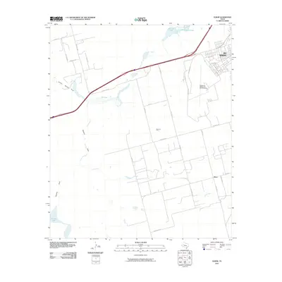
2010 Map of Elbow
USGS Topo · Published 2010About this map
Big Spring and the community of Elbow anchor this Howard County landscape, where the High Plains transition into the drainage systems of the Permian Basin. The map highlights a region defined by its energy and aviation infrastructure, most notably the Moore Oil Field and the Big Spring McMahon-Wrinkle Airport. Transport and water management are central themes, as the interstate corridor cuts across a terrain marked by ephemeral water bodies and draws such as Salt Lake, Threemile Lake, and Sulphur Springs Draw. These features, along with the Elbow School, document the rural social and industrial fabric of West Texas in the early 21st century. The grid of country roads like Cauble Rd and Stallings Rd provides a detailed look at land division and property access in this semi-arid ranching and oil-producing territory.
Find a feature on this map
29 named features on this map. Tap any name to fly to it.
Don’t see what you’re looking for? This feature index may not catch every label — zoom into the map to look around manually.
Map Details
Editions of this 2010 Elbow Map
This is the sole edition of this map. No revisions or reprints were ever made.
Other maps of this area

1941 · Morita
USGS Topo · 1:62,500

1941 · Big Spring South
USGS Topo · 1:62,500

1942 · Big Spring South
USGS Topo · 1:62,500

1942 · Big Spring North
USGS Topo · 1:62,500

1949 · Morita
USGS Topo · 1:62,500

1954 · Big Spring
USGS Topo · 1:250,000

1954 · Big Spring North
USGS Topo · 1:24,000

1958 · Big Spring
USGS Topo · 1:250,000

1965 · Big Spring North
USGS Topo · 1:24,000
1966 · Lucian Wells Ranch
USGS Topo · 1:24,000