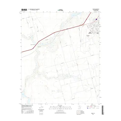
2016 Map of Elbow
USGS Topo · Published 2016About this map
Big Spring and its surrounding high plains landscape are defined by a complex network of seasonal watercourses and drainage basins, including Sulphur Springs Draw, Mustang Draw, and Elbow Cr. This 2016 survey illustrates the modern development of the area, anchored by the Big Spring Mc Mahon-Wrinkle Airport and the residential clusters at Webb Village. The terrain is marked by intermittent lakes such as Salt Lake, Fourmile Lake, and Roberts Lake, which highlight the arid, fluctuating hydrology of Howard County. A dense grid of ranch and county roads like Cauble Rd and Stallings Rd connects isolated homesteads and agricultural tracts to the larger community of Elbow in the southeast, providing a detailed record of land use and transportation during the early 21st century.
Find a feature on this map
54 named features on this map. Tap any name to fly to it.
Don’t see what you’re looking for? This feature index may not catch every label — zoom into the map to look around manually.
Map Details
Editions of this 2016 Elbow Map
This is the sole edition of this map. No revisions or reprints were ever made.
Other maps of this area

1941 · Morita
USGS Topo · 1:62,500

1941 · Big Spring South
USGS Topo · 1:62,500

1942 · Big Spring South
USGS Topo · 1:62,500

1942 · Big Spring North
USGS Topo · 1:62,500

1949 · Morita
USGS Topo · 1:62,500

1954 · Big Spring
USGS Topo · 1:250,000

1954 · Big Spring North
USGS Topo · 1:24,000

1958 · Big Spring
USGS Topo · 1:250,000

1965 · Big Spring North
USGS Topo · 1:24,000
1966 · Lucian Wells Ranch
USGS Topo · 1:24,000