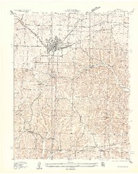
1935 Map of Eldon
USGS Topo · Published 1935About this map
Eldon serves as the central hub of this 1935 survey, where the Chicago Rock Island and Pacific railroad creates a distinct industrial corridor through the northern landscape. The settlement pattern here is deeply connected to transportation, evidenced by the secondary clusters at Aurora Springs and West Aurora, and the presence of the Aurora Springs Sta. This era represents a transition in Missouri's rural infrastructure, where established country schools like Franklin School, Pleasant Hill Sch, and Ginger Ridge Sch dot the ridges above the complex drainage networks of Gravois Creek and Saline Cr.
Find a feature on this map
35 named features on this map. Tap any name to fly to it.
Don’t see what you’re looking for? This feature index may not catch every label — zoom into the map to look around manually.
Map Details
Editions of this 1935 Eldon Map
2 editions found
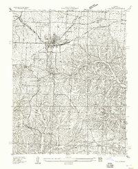
Other maps of this area

1888 · Versailles
USGS Topo · 1:125,000

1888 · Tuscumbia
USGS Topo · 1:125,000

1893 · Versailles
USGS Topo · 1:125,000

1894 · Tuscumbia
USGS Topo · 1:125,000

1904 · Eldon
USGS Topo · 1:62,500

1932 · Versailles No 4
USGS Topo · 1:48,000

1933 · Iberia
USGS Topo · 1:62,500

1934 · Lake Ozark
USGS Topo · 1:24,000

1934 · Bagnell
USGS Topo · 1:24,000

1935 · Rocky Mount
USGS Topo · 1:24,000