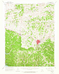
1960 Map of Eldon
USGS Topo · Published 1965About this map
Eldon serves as the primary hub of this Missouri landscape, situated at the junction of the Chicago Rock Island and Pacific railroad and a network of roads leading to smaller communities like Barnett, Olean, and Aurora Springs. The southern portion of the sheet is defined by the rugged topography of Dill Ridge and Thompson Ridge, which descend toward the Lake of the Ozarks. This area reveals a transition from the agricultural plains to the north—dotted with rural institutions like Hopewell Sch and Big Rock Ch—to a more industrially focused interior.
Find a feature on this map
89 named features on this map. Tap any name to fly to it.
Don’t see what you’re looking for? This feature index may not catch every label — zoom into the map to look around manually.
Map Details
Editions of this 1960 Eldon Map
This is the sole edition of this map. No revisions or reprints were ever made.
Other maps of this area

1886 · Jefferson City
USGS Topo · 1:125,000

1888 · Versailles
USGS Topo · 1:125,000

1888 · Tuscumbia
USGS Topo · 1:125,000

1888 · Boonville
USGS Topo · 1:125,000

1893 · Versailles
USGS Topo · 1:125,000

1894 · Tuscumbia
USGS Topo · 1:125,000

1894 · Jefferson City
USGS Topo · 1:125,000

1904 · Eldon
USGS Topo · 1:62,500

1904 · Gravois Mills
USGS Topo · 1:62,500

1932 · Versailles No 4
USGS Topo · 1:48,000