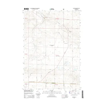
2014 Map of Eldorado
USGS Topo · Published 2014About this map
Huron National Forest dominates this section of Northern Michigan, where the headwaters and tributaries of the South Branch Au Sable River carve through the woodland. The small settlement of Eldorado sits at the junction of Meridian Rd and State Hwy 18, serving as a central point for the surrounding rural area. Further north, Smith Bridge provides a crossing over the Au Sable, a river known for its cold-water ecology and recreational importance.
Find a feature on this map
56 named features on this map. Tap any name to fly to it.
Don’t see what you’re looking for? This feature index may not catch every label — zoom into the map to look around manually.
Map Details
Editions of this 2014 Eldorado Map
This is the sole edition of this map. No revisions or reprints were ever made.
Other maps of this area

1949 · Grayling
USGS Topo · 1:62,500

1950 · Roscommon North
USGS Topo · 1:24,000

1951 · Wakeley Lake
USGS Topo · 1:24,000

1951 · Roscommon North
USGS Topo · 1:24,000

1954 · Traverse City
USGS Topo · 1:250,000

1958 · Traverse City
USGS Topo · 1:250,000

1963 · Luzerne
USGS Topo · 1:24,000

1963 · Roscommon South
USGS Topo · 1:24,000

1963 · Eldorado
USGS Topo · 1:24,000
1963 · Luzerne NW
USGS Topo · 1:24,000
Featured Places
- Higgins Township, MI
- Grayling Charter Township, MI
- South Branch Township, MI
- Au Sable Township, MI
- Eldorado, MI