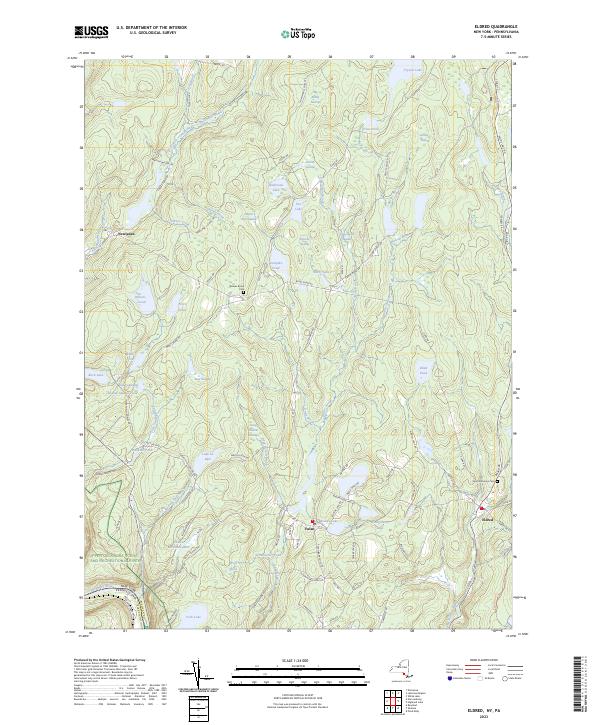
2023 Map of Eldred
USGS Topo · Published 2023About this map
Eldred and Yulan anchor this portion of Sullivan County, situated in a landscape defined by an intricate network of waterways and wetlands. The local geography is marked by a high density of swamps and ponds, such as Big Brady Swamp, Froschs Swamp, and Halfmoon Lake, which feed the many creeks like Beaver Brook and Balsam Brook. The southern boundary follows the Upper Delaware Scenic and Recreational River, highlighting the transition from the upland plateau down toward the river valley at the Pennsylvania state line.
Find a feature on this map
112 named features on this map. Tap any name to fly to it.
Don’t see what you’re looking for? This feature index may not catch every label — zoom into the map to look around manually.
Map Details
Editions of this 2023 Eldred Map
This is the sole edition of this map. No revisions or reprints were ever made.
Other maps of this area

1913 · Milford
USGS Topo · 1:62,500

1915 · Milford
USGS Topo · 1:62,500

1920 · Damascus
USGS Topo · 1:62,500

1922 · White Lake
USGS Topo · 1:62,500

1923 · Damascus
USGS Topo · 1:62,500

1935 · Hawley
USGS Topo · 1:62,500

1938 · Hawley
USGS Topo · 1:62,500

1942 · White Lake
USGS Topo · 1:62,500

1943 · Honesdale
USGS Topo · 1:125,000

1943 · White Lake
USGS Topo · 1:62,500