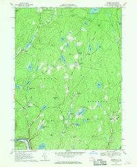
1967 Map of Eldred
USGS Topo · Published 1970About this map
Eldred and Yulan anchor this late 1960s landscape in Sullivan County, where the southern boundary is defined by the winding Delaware River. The area is characterized by an extensive network of small lakes and ponds, including Washington Lake, Bodine Lake, and the remote Wolf Pond. Settlement patterns follow the valleys of Beaver Brook and Halfway Brook, with local institutions like St Anthonys Cem and Central Sch serving the rural community.
Find a feature on this map
81 named features on this map. Tap any name to fly to it.
Don’t see what you’re looking for? This feature index may not catch every label — zoom into the map to look around manually.
Map Details
Editions of this 1967 Eldred Map
2 editions found
Other maps of this area

1913 · Milford
USGS Topo · 1:62,500

1915 · Milford
USGS Topo · 1:62,500

1920 · Damascus
USGS Topo · 1:62,500

1922 · White Lake
USGS Topo · 1:62,500

1923 · Damascus
USGS Topo · 1:62,500

1935 · Hawley
USGS Topo · 1:62,500

1938 · Hawley
USGS Topo · 1:62,500

1942 · White Lake
USGS Topo · 1:62,500

1943 · Honesdale
USGS Topo · 1:125,000

1943 · White Lake
USGS Topo · 1:62,500