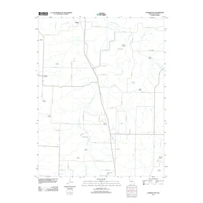
2011 Map of Eldridge East
USGS Topo · Published 2011About this map
Goodwin Hollow Creek and Dry Auglaize Creek carve through this section of Laclede County, defining a landscape of hollows and ridges where small settlements like Grace, Eldridge, and Dove are connected by a network of winding roads. The geography is notably punctuated by a high density of family and community burial grounds, including Hufft Cemetery, Bradshaw Cemetery, and Mizer Cemetery, which serve as vital markers of the area's genealogical history. In the south, the Capoferri Lake Dam contains Capoferri Lake, while smaller water bodies like Reagan Pond and Goss Pond appear across the eastern terrain. Named landmarks such as High Hollow and Holman Hollow highlight the deep-cut relief of the Ozark plateau, providing a clear view of the rural settlement patterns that have persisted into the twenty-first century.
Find a feature on this map
61 named features on this map. Tap any name to fly to it.
Don’t see what you’re looking for? This feature index may not catch every label — zoom into the map to look around manually.
Map Details
Editions of this 2011 Eldridge East Map
This is the sole edition of this map. No revisions or reprints were ever made.
Other maps of this area

1933 · Stoutland
USGS Topo · 1:62,500

1934 · Macks Creek
USGS Topo · 1:48,000

1938 · Stoutland
USGS Topo · 1:62,500

1939 · Macks Creek
USGS Topo · 1:62,500

1939 · Long Lane
USGS Topo · 1:62,500

1941 · Lebanon
USGS Topo · 1:62,500

1942 · Long Lane
USGS Topo · 1:62,500

1943 · Lebanon
USGS Topo · 1:62,500

1954 · Springfield
USGS Topo · 1:250,000

1958 · Springfield
USGS Topo · 1:250,000