
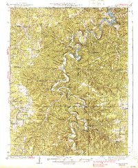
1939 Map of Macks Creek
USGS Topo · Published 1939About this map
Niangua River and Little Niangua River carve deep, winding channels through Camden County, meeting the backwaters of Lake of the Ozarks in the northeast. The 1930s landscape is defined by its water-driven history, featuring the impressive Tunnel Dam and the ruins of Hahatonka Castle overlooking Hahatonka Spring. Away from the main riverbanks, the terrain is a network of named hollows like Turkeypen Hollow and Sugarcamp Hol, punctuated by one-room schoolhouses such as Leadmine Sch and Victory Sch. Travel in this era relied on a series of critical river crossings, including Berry Ford and Smith Ford, which connected small communities like Macks Creek and Corkery. The map also captures the early recreational development of the Ozarks, noted by Mead Camp and the Red Arrow Club near the river bluffs.
Find a feature on this map
103 named features on this map. Tap any name to fly to it.
Don’t see what you’re looking for? This feature index may not catch every label — zoom into the map to look around manually.
Map Details
Editions of this 1939 Macks Creek Map
2 editions found
Other maps of this area

1884 · Bolivar
USGS Topo · 1:125,000

1887 · Warsaw
USGS Topo · 1:125,000

1888 · Versailles
USGS Topo · 1:125,000

1892 · Bolivar
USGS Topo · 1:125,000

1893 · Versailles
USGS Topo · 1:125,000

1894 · Warsaw
USGS Topo · 1:125,000

1932 · Versailles No 4
USGS Topo · 1:48,000

1933 · Stoutland
USGS Topo · 1:62,500

1934 · Macks Creek
USGS Topo · 1:48,000

1934 · Camdenton
USGS Topo · 1:24,000