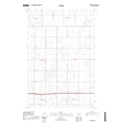
2020 Map of Eldridge NW
USGS Topo · Published 2020About this map
Minneapolis Flats Cr meanders across this rural section of the North Dakota prairie, defining a landscape of low-lying wetlands and seasonal drainage patterns. This 2020 topographic record shows a meticulously surveyed grid of township and range lines, where the land is carved into sections such as t140n r65w and t140n r66w. The most significant water body, Adkinson Lake, sits in the southern portion of the map, serving as a primary landmark in an otherwise largely agricultural expanse. The area is intersected by a strictly maintained network of section-line roads, including Co Hwy 65 and 36th St, which facilitate the movement of goods and people through this sparsely populated territory. This survey effectively captures the modern state of the northern Great Plains, where the geometry of the Public Land Survey System remains the dominant organizing force of the terrain.
Find a feature on this map
24 named features on this map. Tap any name to fly to it.
Don’t see what you’re looking for? This feature index may not catch every label — zoom into the map to look around manually.
Map Details
Editions of this 2020 Eldridge NW Map
This is the sole edition of this map. No revisions or reprints were ever made.
Other maps of this area

1896 · Jamestown
USGS Topo · 1:125,000

1900 · Pingree
USGS Topo · 1:125,000

1900 · Pingree
USGS Topo · 1:62,500

1950 · Buchanan
USGS Topo · 1:24,000

1951 · Eldridge SE
USGS Topo · 1:24,000

1951 · Eldridge NW
USGS Topo · 1:24,000

1952 · Buchanan
USGS Topo · 1:24,000

1952 · Eldridge
USGS Topo · 1:24,000

1952 · Pingree SW
USGS Topo · 1:24,000

1952 · Eldridge SW
USGS Topo · 1:24,000