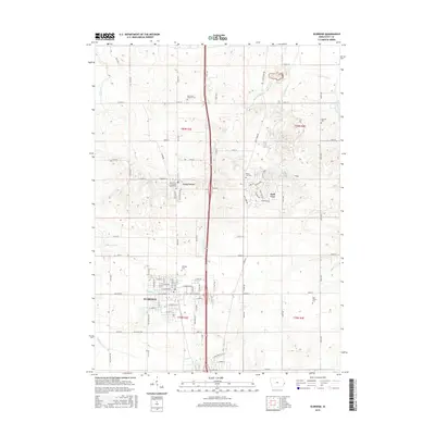
2015 Map of Eldridge
USGS Topo · Published 2015About this map
Eldridge serves as a central hub for this portion of Scott County, where the street grid expands near the intersection of Leclaire Rd and 155th Ave. The landscape is a study in Iowa's agricultural and suburban development, punctuated by numerous historic burial grounds that offer significant value for genealogists, including Saint Anns Catholic Cem and the Long Grove Christian Church Cem near Long Grove. The transition from rural acreage to the planned residential loops of Park View illustrates the changing density of the region. Local waterways like McDonald Cr, Glynn Cr, and Hickory Cr drain the surrounding fields, while smaller named locations such as Donahue and Jumbo anchor the outlying sections of the map. This survey provides a clear look at the township boundaries of t80n r3e and t79n r4e during the mid-2010s.
Find a feature on this map
93 named features on this map. Tap any name to fly to it.
Don’t see what you’re looking for? This feature index may not catch every label — zoom into the map to look around manually.
Map Details
Editions of this 2015 Eldridge Map
This is the sole edition of this map. No revisions or reprints were ever made.
Other maps of this area

1891 · DeWitt
USGS Topo · 1:62,500

1891 · Davenport
USGS Topo · 1:62,500

1892 · Goose Lake
USGS Topo · 1:62,500

1892 · Leclaire
USGS Topo · 1:62,500

1893 · Leclaire
USGS Topo · 1:62,500

1894 · Goose Lake
USGS Topo · 1:62,500

1894 · Davenport
USGS Topo · 1:62,500

1899 · Clinton
USGS Topo · 1:125,000

1901 · Rock Island
USGS Topo · 1:125,000

1910 · Rock Island
USGS Topo · 1:125,000