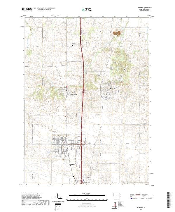
2022 Map of Eldridge
USGS Topo · Published 2022About this map
The growing community of Eldridge serves as the primary hub in this portion of Scott County, positioned at the junction of Leclaire Rd and local routes like 155th Ave. The landscape transitions from the residential developments of Park View to the more rural north, where Long Grove is situated near several historic religious sites. Genealogists and local historians will find a high concentration of burial grounds, including the Long Grove Christian Church Cem and the small Kay Family Cem to the east. The terrain is defined by a series of north-south drainage systems such as McDonald Cr, Glynn Cr, and Spencer Cr, which carve through the agricultural fields and influence the grid of county roads. Modern recreational infrastructure is also evident, most notably the Lester Matzen Bike Path Trl running through the heart of Eldridge.
Find a feature on this map
62 named features on this map. Tap any name to fly to it.
Don’t see what you’re looking for? This feature index may not catch every label — zoom into the map to look around manually.
Map Details
Editions of this 2022 Eldridge Map
This is the sole edition of this map. No revisions or reprints were ever made.
Other maps of this area

1891 · DeWitt
USGS Topo · 1:62,500

1891 · Davenport
USGS Topo · 1:62,500

1892 · Goose Lake
USGS Topo · 1:62,500

1892 · Leclaire
USGS Topo · 1:62,500

1893 · Leclaire
USGS Topo · 1:62,500

1894 · Goose Lake
USGS Topo · 1:62,500

1894 · Davenport
USGS Topo · 1:62,500

1899 · Clinton
USGS Topo · 1:125,000

1901 · Rock Island
USGS Topo · 1:125,000

1910 · Rock Island
USGS Topo · 1:125,000