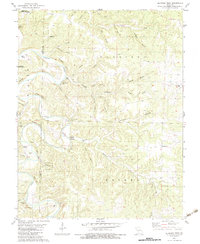
1982 Map of Eldridge West
USGS Topo · Published 1983About this map
The Niangua River carves a winding path through the Ozarks of Dallas and Laclede counties, defining a landscape of high bluffs and deep hollows. This early 1980s survey illustrates a region where family history and land use are etched into the terrain, from the Turner Cem on the western heights to the Ballard Cem in the central valleys. Small communities like Eldridge and Prosperine serve as anchor points for a rural road network that navigates around named features like Indian Leap Bluff and Guthrie Bluff. The abundance of named springs, such as Blue Spring and Barclay Spring, alongside protected lands like Lead Mine State Forest, indicates a geography deeply tied to the river's hydrology and timber resources. Local genealogists will find several rural burial grounds, including the Keith Cem near Brush Cr, documenting the era's scattered homesteading patterns.
Find a feature on this map
59 named features on this map. Tap any name to fly to it.
Don’t see what you’re looking for? This feature index may not catch every label — zoom into the map to look around manually.
Map Details
Editions of this 1982 Eldridge West Map
This is the sole edition of this map. No revisions or reprints were ever made.
Other maps of this area

1933 · Stoutland
USGS Topo · 1:62,500

1934 · Macks Creek
USGS Topo · 1:48,000

1938 · Stoutland
USGS Topo · 1:62,500

1939 · Macks Creek
USGS Topo · 1:62,500

1939 · Long Lane
USGS Topo · 1:62,500

1941 · Lebanon
USGS Topo · 1:62,500

1942 · Long Lane
USGS Topo · 1:62,500

1943 · Lebanon
USGS Topo · 1:62,500

1954 · Springfield
USGS Topo · 1:250,000

1958 · Springfield
USGS Topo · 1:250,000