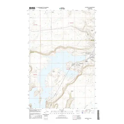
2017 Map of Electric City
USGS Topo · Published 2017About this map
Electric City and the neighboring settlements of Grand Coulee, Upper Grand Coulee, and Delano Heights define the residential and commercial landscape perched above the expansive waters of Banks Lake. This high-desert environment in the late 2010s is characterized by striking geological formations, including the prominent basalt massifs of Steamboat Rock, Castle Rock, and Eagle Rock rising from the Coulee floor. The map illustrates a complex intersection of infrastructure and topography, where roads like Coulee Blvd and Alcan RD NE navigate the steep drops into Northrup Canyon. Away from the urban centers, aviation facilities such as the Grand Coulee Dam Airport and Rice Ranch Airport serve the region, while the interior draws interest with secluded water bodies like Osborn Bay Lake, Fish Lake, and Northrup Lake, all set against the dramatic vertical relief of the Coulee walls.
Find a feature on this map
45 named features on this map. Tap any name to fly to it.
Don’t see what you’re looking for? This feature index may not catch every label — zoom into the map to look around manually.
Map Details
Editions of this 2017 Electric City Map
This is the sole edition of this map. No revisions or reprints were ever made.
Other maps of this area

1948 · Grand Coulee Dam
USGS Topo · 1:62,500

1950 · Grand Coulee Dam
USGS Topo · 1:62,500

1950 · Nespelem
USGS Topo · 1:62,500

1950 · Alameda Flat
USGS Topo · 1:62,500

1952 · Alameda Flat
USGS Topo · 1:62,500

1953 · Ritzville
USGS Topo · 1:250,000

1954 · Okanogan
USGS Topo · 1:250,000

1958 · Okanogan
USGS Topo · 1:250,000

1959 · Ritzville
USGS Topo · 1:250,000

1965 · Ritzville
USGS Topo · 1:250,000