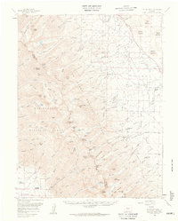
1959 Map of Electric Peak
USGS Topo · Published 1961About this map
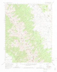
The San Isabel National Forest and Rio Grande National Forest define the high country of the Sangre de Cristo Range in the late 1950s. The landscape is characterized by prominent peaks like Electric Peak and Spread Eagle Peak, with the continental divide separating the watersheds of Texas Creek and the Alto Creek. Below the timberline, the map records the legacy of early mountain settlement, from the Cloverdale Mine and Stover Mine to established family sites such as the King Homestead and Hutchinson Homestead.
Find a feature on this map
122 named features on this map. Tap any name to fly to it.
Don’t see what you’re looking for? This feature index may not catch every label — zoom into the map to look around manually.
Map Details
Editions of this 1959 Electric Peak Map
6 editions found

Other maps of this area

1889 · Canon City
USGS Topo · 1:125,000

1889 · Huerfano Park
USGS Topo · 1:125,000

1892 · Huerfano Park
USGS Topo · 1:125,000

1892 · Canon City
USGS Topo · 1:125,000

1950 · Valley View Hot Springs
USGS Topo · 1:24,000

1954 · Trinidad
USGS Topo · 1:250,000

1954 · Pueblo
USGS Topo · 1:250,000

1955 · Westcliffe
USGS Topo · 1:24,000

1955 · Trinidad
USGS Topo · 1:250,000

1957 · Pueblo
USGS Topo · 1:250,000