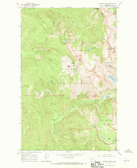
1966 Map of Elephant Peak
USGS Topo · Published 1970About this map
The Cabinet Mountains Wilderness defines this high-altitude landscape, straddling the boundary between the Kaniksu National Forest and Kootenai National Forest. The map centers on a series of prominent summits including Elephant Peak and Saint Paul Peak, which rise above alpine waters like Saint Paul Lake and the Libby Lakes. A distinct mining history is evident at the Heidelberg Mine near Heidelberg Falls, situated just north of the Rock Creek Meadows. The terrain is navigated primarily by a network of paths such as the Pack Trail that follows the East Fork Bull River. This 1960s survey documents the transition into protected wilderness, tracing the Wilderness Boundary through the Moran Basin and across the rugged Milwaukee Pass.
Find a feature on this map
44 named features on this map. Tap any name to fly to it.
Don’t see what you’re looking for? This feature index may not catch every label — zoom into the map to look around manually.
Map Details
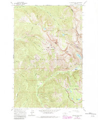
Editions of this 1966 Elephant Peak Map
2 editions found
Other maps of this area

1920 · Libby
USGS Topo · 1:125,000

1930 · Libby
USGS Topo · 1:125,000

1932 · Libby
USGS Topo · 1:125,000

1932 · Trout Creek
USGS Topo · 1:125,000

1935 · Trout Creek
USGS Topo · 1:125,000

1936 · Trout Creek
USGS Topo · 1:125,000

1956 · Wallace
USGS Topo · 1:250,000

1957 · Kalispell
USGS Topo · 1:250,000

1960 · Kalispell
USGS Topo · 1:250,000

1960 · Wallace
USGS Topo · 1:250,000