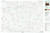
1980 Map of Elgin
USGS Topo · Published 1980About this map
The Cannonball River winds through this 1980 landscape, serving as a central artery for a region defined by agricultural settlements and significant tribal lands. To the south, the Standing Rock Indian Reservation occupies a substantial portion of the territory, while the Grand River National Grasslands stretch across the southwestern sections. The map captures the infrastructure of the Chicago Milwaukee St Paul and Pacific and Northern Pacific railroads, which historically linked towns like Elgin and New Leipzig to wider markets.
Find a feature on this map
87 named features on this map. Tap any name to fly to it.
Don’t see what you’re looking for? This feature index may not catch every label — zoom into the map to look around manually.
Map Details
Editions of this 1980 Elgin Map
This is the sole edition of this map. No revisions or reprints were ever made.
Other maps of this area

1907 · Bismarck
USGS Topo · 1:125,000

1938 · Heart Butte
USGS Topo · 1:48,000

1944 · Heart Butte
USGS Topo · 1:62,500

1953 · McIntosh
USGS Topo · 1:250,000

1953 · Dickinson
USGS Topo · 1:250,000

1954 · Lemmon
USGS Topo · 1:250,000

1954 · Bismarck
USGS Topo · 1:250,000

1957 · Dickinson
USGS Topo · 1:250,000

1957 · Lemmon
USGS Topo · 1:250,000

1958 · Bismarck
USGS Topo · 1:250,000