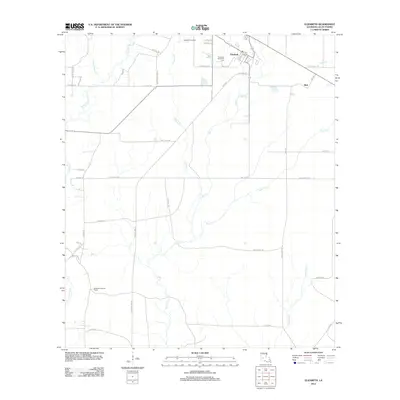
2012 Map of Elizabeth
USGS Topo · Published 2012About this map
Elizabeth occupies the northern reaches of this Allen Parish landscape, serving as a hub of local activity near the Elizabeth Gas Field. The settlement's residential grid, including streets like Beech St and Hickory St, contrasts with the surrounding network of timber and access roads. To the south, the Elizabeth Lookout Tower stands as a notable landmark overlooking a drainage system defined by Tenmile Cr and Mill Cr. The presence of Hampton Memorial Cem and the small locality of Mab provide touchpoints for genealogical research and local history. The terrain is deeply etched by a complex web of waterways, including Alligator Cr, Black Cr, and Little Mill Cr, which dictate the placement of early routes such as Old Main-Line Rd and Indian Cove Rd.
Find a feature on this map
46 named features on this map. Tap any name to fly to it.
Don’t see what you’re looking for? This feature index may not catch every label — zoom into the map to look around manually.
Map Details
Editions of this 2012 Elizabeth Map
This is the sole edition of this map. No revisions or reprints were ever made.
Other maps of this area

1935 · Mittie
USGS Topo · 1:31,680

1935 · Pawnee
USGS Topo · 1:31,680

1935 · Oakdale
USGS Topo · 1:31,680

1942 · Oakdale
USGS Topo · 1:62,500

1947 · Foley
USGS Topo · 1:31,680

1947 · Steep Gully
USGS Topo · 1:31,680

1947 · Pine Chapel
USGS Topo · 1:31,680

1947 · Elizabeth
USGS Topo · 1:31,680

1947 · Grant
USGS Topo · 1:31,680

1947 · Pitkin
USGS Topo · 1:31,680