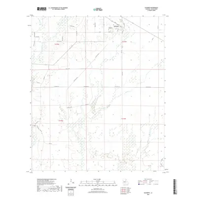
2020 Map of Elizabeth
USGS Topo · Published 2020About this map
The town of Elizabeth sits at the intersection of local routes in north Allen Parish, defined by a landscape of creek systems and old logging or transit lines. This modern survey reflects the enduring grid of the town center, where Hampton Memorial Cem and streets like Main St and Pecan mark the settlement's core. Surrounding the town, a network of waterways including Tenmile Cr and Alligator Cr drain the lowlands, while named roads like Buddy Moore Rd and Poor Ridge Run Rd trace the rural periphery. Evidence of the region's industrial past is seen in the frequent references to rail and transport history, such as Old Main Line Rd, Trammel Rd, and Tram Rd, which likely follow former timber or freight corridors. Turner Cem remains a notable landmark in the southwestern portion of the sheet near Palestine Rd.
Find a feature on this map
41 named features on this map. Tap any name to fly to it.
Don’t see what you’re looking for? This feature index may not catch every label — zoom into the map to look around manually.
Map Details
Editions of this 2020 Elizabeth Map
This is the sole edition of this map. No revisions or reprints were ever made.
Other maps of this area

1935 · Mittie
USGS Topo · 1:31,680

1935 · Pawnee
USGS Topo · 1:31,680

1935 · Oakdale
USGS Topo · 1:31,680

1942 · Oakdale
USGS Topo · 1:62,500

1947 · Foley
USGS Topo · 1:31,680

1947 · Steep Gully
USGS Topo · 1:31,680

1947 · Pine Chapel
USGS Topo · 1:31,680

1947 · Elizabeth
USGS Topo · 1:31,680

1947 · Grant
USGS Topo · 1:31,680

1947 · Pitkin
USGS Topo · 1:31,680