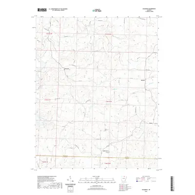
2020 Map of Elizabeth
USGS Topo · Published 2020About this map
Elizabeth sits as a primary settlement in this Ozark foothills landscape, characterized by a complex network of creeks and drainage basins. The area is defined by the winding course of Big Creek and its various tributaries, including Taylor-Foster Br and N Brushy Cr. This 2020 survey captures the rural character of northern Arkansas, where the county line between Fulton and Izard counties divides the terrain. Smaller communities like Mitchell, Wild Cherry, and Bexar are connected by a web of county roads that navigate the ridges and hollows, such as Kerley Point Cove. Genealogists will find notable points of interest in rural burial grounds like Smith Chapel Cem and Myse Cem, which remain as long-standing landmarks in a region largely defined by its timbered hills and agricultural clearings.
Find a feature on this map
60 named features on this map. Tap any name to fly to it.
Don’t see what you’re looking for? This feature index may not catch every label — zoom into the map to look around manually.
Map Details
Editions of this 2020 Elizabeth Map
This is the sole edition of this map. No revisions or reprints were ever made.
Other maps of this area

1890 · Mountain Home
USGS Topo · 1:125,000

1891 · Mountain Home
USGS Topo · 1:125,000

1894 · Mountain Home
USGS Topo · 1:125,000

1945 · Harrison
USGS Topo · 1:250,000

1949 · Harrison
USGS Topo · 1:250,000

1950 · Salem
USGS Topo · 1:62,500

1951 · Salem
USGS Topo · 1:62,500

1951 · Melbourne
USGS Topo · 1:62,500

1954 · Harrison
USGS Topo · 1:250,000

1957 · Poplar Bluff
USGS Topo · 1:250,000