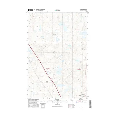
2016 Map of Elizabeth
USGS Topo · Published 2016About this map
Elizabeth occupies the southeastern corner of this map, situated in a glaciated landscape characterized by numerous potholes and basins. The terrain is defined by its water bodies, including the centrally located Lake Haldorsen, Nelson Lake to the northwest, and Christopherson Lake in the northeast. This area of Otter Tail County demonstrates a high density of rural cemeteries and churches, serving as a vital record for local genealogy and settlement history. Genealogists can identify specific sites such as the Hedemarken Lutheran Church Cem, Old Friborg Cem, and the Evangelical Lutheran Kirchof Cem. The road network, featuring Old Hwy 52 and Co Hwy 10, illustrates the transport patterns connecting these dispersed farmsteads and religious centers within the townships of t135n r44w, t135n r43w, t134n r44w, and t134n r43w.
Find a feature on this map
36 named features on this map. Tap any name to fly to it.
Don’t see what you’re looking for? This feature index may not catch every label — zoom into the map to look around manually.
Map Details
Editions of this 2016 Elizabeth Map
This is the sole edition of this map. No revisions or reprints were ever made.
Other maps of this area

1913 · Fergus Falls
USGS Topo · 1:62,500

1914 · Pelican Rapids
USGS Topo · 1:62,500

1917 · Pelican Rapids
USGS Topo · 1:62,500

1919 · Rothsay
USGS Topo · 1:62,500

1919 · Barnesville
USGS Topo · 1:62,500

1951 · Rothsay
USGS Topo · 1:62,500

1952 · Barnesville
USGS Topo · 1:62,500

1953 · Fargo
USGS Topo · 1:250,000

1956 · Fargo
USGS Topo · 1:250,000

1966 · Carlisle
USGS Topo · 1:24,000