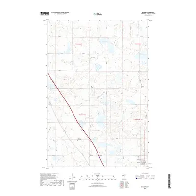
2019 Map of Elizabeth
USGS Topo · Published 2019About this map
Elizabeth sits in the southeastern corner of this quadrangle, surrounded by a glacial landscape defined by numerous kettle lakes and scattered rural cemeteries. The area is dotted with significant local landmarks such as Nelson Lake, Houland Lake, and Lake Haldorsen, which dominate the central terrain. For genealogists, the map is particularly valuable for its documentation of burial sites including the Old Friborg Cem, South Friborg Cem, and the Zion Elizabeth Cem. The presence of the Hedemarken Lutheran Church Cem and the Evangelical Lutheran Kirchof Cem reflects the Scandinavian heritage and religious settlement patterns of Otter Tail County. The road network, including Old Hwy 52 and various county routes like Co Hwy 10, connects these remote farmsteads and religious centers, following the natural undulations of the prairie and wetland terrain.
Find a feature on this map
36 named features on this map. Tap any name to fly to it.
Don’t see what you’re looking for? This feature index may not catch every label — zoom into the map to look around manually.
Map Details
Editions of this 2019 Elizabeth Map
This is the sole edition of this map. No revisions or reprints were ever made.
Other maps of this area

1913 · Fergus Falls
USGS Topo · 1:62,500

1914 · Pelican Rapids
USGS Topo · 1:62,500

1917 · Pelican Rapids
USGS Topo · 1:62,500

1919 · Rothsay
USGS Topo · 1:62,500

1919 · Barnesville
USGS Topo · 1:62,500

1951 · Rothsay
USGS Topo · 1:62,500

1952 · Barnesville
USGS Topo · 1:62,500

1953 · Fargo
USGS Topo · 1:250,000

1956 · Fargo
USGS Topo · 1:250,000

1966 · Carlisle
USGS Topo · 1:24,000