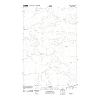
2011 Map of Elk Butte
USGS Topo · Published 2011About this map
Elk Butte Mountain Hemlock Area anchors this 2011 survey, a landscape defined by industrial logging history and high-country peaks in Clearwater County. The presence of numbered and named outposts like Diamond Match Camp, Camp Forty-Three, and Bark Camp reflects the region's historical timber operations, many of which are linked by the rugged path of the Burma Rd. These camps were essential hubs in the harvesting of Idaho's timber, often situated near vital water sources such as Breakfast Creek and Gold Creek. The topography rises sharply to Elk Butte and Green Mountain, while long features like Sourdough Ridge and Elmberry Ridge divide the numerous drainage basins. This modern topographic record preserves the locations of these remote stations and cabins, providing a clear view of the wilderness infrastructure used to manage and extract resources from these forests.
Find a feature on this map
29 named features on this map. Tap any name to fly to it.
Don’t see what you’re looking for? This feature index may not catch every label — zoom into the map to look around manually.
Map Details
Editions of this 2011 Elk Butte Map
This is the sole edition of this map. No revisions or reprints were ever made.
Other maps of this area

1923 · Washington Creek
USGS Topo · 1:125,000

1936 · Boehls Butte
USGS Topo · 1:48,000

1938 · Headquarters
USGS Topo · 1:48,000

1943 · Boehls Butte
USGS Topo · 1:62,500

1944 · Headquarters
USGS Topo · 1:62,500

1955 · Pullman
USGS Topo · 1:250,000

1956 · Hamilton
USGS Topo · 1:250,000

1958 · Pullman
USGS Topo · 1:250,000

1959 · Hamilton
USGS Topo · 1:250,000

1960 · Hamilton
USGS Topo · 1:250,000