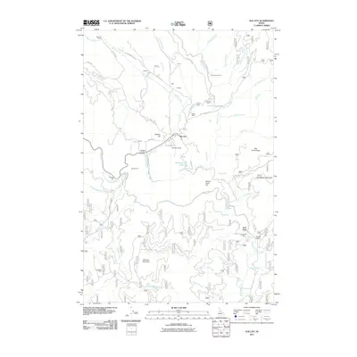
2011 Map of Elk City
USGS Topo · Published 2011About this map
Elk City serves as the central hub of this mountain region, where the historical legacy of the Idaho gold rush is written into the landscape through numerous extraction sites. The town is surrounded by significant mining operations, including the Buster Mine, Alamance Mine, and the Sultan Shaft, reflecting a long-standing mineral economy. Transport through the drainage of Big Elk Creek and along the South Fork Clearwater River follows established corridors like the Old Elk City Wagon Rd, which hints at the area's development during the early transit era. To the south and east, the terrain rises toward Wheeler Mountain and Blue Ribbon Mountain, punctuated by industrial landmarks like the Shearer Mill and the Cal-Idaho Pit. Further south, the Gold Point Mine near French Gulch and the Grangeville Mine west of Wheeler Creek indicate the extent of prospecting that once defined these remote ridges and valleys.
Find a feature on this map
77 named features on this map. Tap any name to fly to it.
Don’t see what you’re looking for? This feature index may not catch every label — zoom into the map to look around manually.
Map Details
Editions of this 2011 Elk City Map
This is the sole edition of this map. No revisions or reprints were ever made.
Other maps of this area

1931 · Buffalo Hump
USGS Topo · 1:125,000

1934 · Buffalo Hump
USGS Topo · 1:125,000

1956 · Elk City
USGS Topo · 1:250,000

1960 · Elk City
USGS Topo · 1:250,000

1962 · Center Star Mtn
USGS Topo · 1:24,000

1962 · Iron Mtn
USGS Topo · 1:24,000

1966 · Elk City
USGS Topo · 1:24,000

1966 · Black Hawk Mtn
USGS Topo · 1:24,000

1966 · Lick Point
USGS Topo · 1:24,000

1966 · Anderson Butte
USGS Topo · 1:24,000