
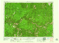
1960 Map of Elk City
USGS Topo · Published 1960About this map
Salmon River canyons and the high peaks of the Bitterroot Range dominate this mid-century survey of Central Idaho. The landscape is defined by the massive convergence of the Bitterroot National Forest, Nezperce National Forest, Payette National Forest, and Salmon National Forest. This era of documentation highlights a significant mining economy, specifically noting industrial operations like the Blackbird Mine at Cobalt and the Yellow Pine Mine, which was a vital source for antimony and tungsten.
Find a feature on this map
51 named features on this map. Tap any name to fly to it.
Don’t see what you’re looking for? This feature index may not catch every label — zoom into the map to look around manually.
Map Details
Editions of this 1960 Elk City Map
2 editions found
Other maps of this area

1901 · Hamilton
USGS Topo · 1:125,000

1909 · Sapphire
USGS Topo · 1:125,000

1911 · Meadows
USGS Topo · 1:125,000

1911 · Lolo
USGS Topo · 1:250,000

1913 · Lolo
USGS Topo · 1:250,000

1924 · Kamiah
USGS Topo · 1:125,000

1924 · Weippe
USGS Topo · 1:125,000

1930 · Casto
USGS Topo · 1:125,000

1931 · Buffalo Hump
USGS Topo · 1:125,000

1934 · Buffalo Hump
USGS Topo · 1:125,000