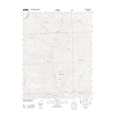
2013 Map of Elk Creek
USGS Topo · Published 2013About this map
San Juan National Forest defines this high-elevation landscape in La Plata County, where the drainage basin for the S Fork Hermosa Cr and its numerous tributaries creates a complex system of ridges and canyons. The terrain is marked by distinctive depressions and clearings such as North Hole, South Hole, and Hermosa Park, which offer breaks in the dense forest cover. A well-established network of trails, including the Highline Trail / Colorado Trail 520 and Hermosa Creek Trail 514, serves as the primary infrastructure through these mountain reaches. This 2013 survey illustrates how water and topography dictate movement through the region, with trails often following the paths of least resistance through areas like Lone Spruce Draw or alongside Big Bend Cr and Salt Cr.
Find a feature on this map
40 named features on this map. Tap any name to fly to it.
Don’t see what you’re looking for? This feature index may not catch every label — zoom into the map to look around manually.
Map Details
Editions of this 2013 Elk Creek Map
This is the sole edition of this map. No revisions or reprints were ever made.
Other maps of this area

1895 · La Plata
USGS Topo · 1:62,500

1897 · La Plata
USGS Topo · 1:62,500

1897 · Rico
USGS Topo · 1:62,500

1898 · Durango
USGS Topo · 1:62,500

1898 · Engineer Mountain
USGS Topo · 1:62,500

1898 · Rico
USGS Topo · 1:62,500

1899 · La Plata
USGS Topo · 1:62,500

1899 · Rico
USGS Topo · 1:62,500

1900 · Engineer Mountain
USGS Topo · 1:62,500

1907 · Durango
USGS Topo · 1:62,500