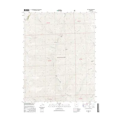
2016 Map of Elk Creek
USGS Topo · Published 2016About this map
San Juan National Forest encompasses this high-altitude landscape along the Continental Divide, where steep drainages and mountain trails define the geography. The primary artery of the area is Hermosa Cr, which flows through the center of the sheet, joined by numerous tributaries such as Big Bend Cr and Deer Cr. This 2016 survey provides a record of the complex trail systems that navigate the terrain, including the Highline Trail / Colorado Trail on the western edge and the Hermosa Creek Trail following the main watercourse. Distinctive geological features like Blind Canyon, North Hole, and Lone Spruce Draw offer specific reference points for those studying the physical landmarks of the region. The map also delineates the boundary between Montezuma and La Plata counties, intersecting the upper reaches of Salt Cr.
Find a feature on this map
44 named features on this map. Tap any name to fly to it.
Don’t see what you’re looking for? This feature index may not catch every label — zoom into the map to look around manually.
Map Details
Editions of this 2016 Elk Creek Map
This is the sole edition of this map. No revisions or reprints were ever made.
Other maps of this area

1895 · La Plata
USGS Topo · 1:62,500

1897 · La Plata
USGS Topo · 1:62,500

1897 · Rico
USGS Topo · 1:62,500

1898 · Durango
USGS Topo · 1:62,500

1898 · Engineer Mountain
USGS Topo · 1:62,500

1898 · Rico
USGS Topo · 1:62,500

1899 · La Plata
USGS Topo · 1:62,500

1899 · Rico
USGS Topo · 1:62,500

1900 · Engineer Mountain
USGS Topo · 1:62,500

1907 · Durango
USGS Topo · 1:62,500