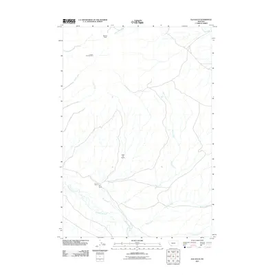
2011 Map of Elk Gulch
USGS Topo · Published 2011About this map
Benson Peak anchors the high ground of this southwestern Montana landscape, overlooking a complex drainage network defined by Sweetwater Creek and Moose Creek. The area's industrial history is marked by the presence of the Graphite Birds Nest Mine in the northwest, suggesting the region's mineral potential during the early 21st century. The map reveals a sparse ranching and mining footprint, with the Brown Ranch situated near the junction of mountain drainages at Elk Gulch. The terrain is deeply incised by numerous waterways including Blacktail Deer Creek, Wagner Creek, and Crazy Springs Creek, which carve through the valleys south of Little Elk Gulch. This map provides a clear record of the physical geography and land use in Beaverhead County, showing the intersection of natural water courses like Timber Creek and Cabin Creek with the localized human activity at the ranch and mine site.
Find a feature on this map
12 named features on this map. Tap any name to fly to it.
Don’t see what you’re looking for? This feature index may not catch every label — zoom into the map to look around manually.
Map Details
Editions of this 2011 Elk Gulch Map
This is the sole edition of this map. No revisions or reprints were ever made.
Other maps of this area

1893 · Dillon
USGS Topo · 1:250,000

1955 · Dubois
USGS Topo · 1:250,000

1955 · Dillon
USGS Topo · 1:250,000

1957 · Dillon
USGS Topo · 1:250,000

1958 · Dubois
USGS Topo · 1:250,000

1958 · Dillon
USGS Topo · 1:250,000

1961 · Mine Gulch
USGS Topo · 1:24,000

1961 · Christensen Ranch
USGS Topo · 1:24,000

1961 · Red Canyon
USGS Topo · 1:24,000

1961 · Ashbough Canyon
USGS Topo · 1:24,000