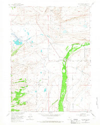
1955 Map of Elk Mountain
USGS Topo · Published 1966About this map
The Medicine Bow River defines the eastern landscape of this Wyoming territory, where ranching operations such as Menke Ranch and Haglund Ranch sit along its banks. The terrain is marked by the high elevations of the Saddleback Hills and the transit route of Rattlesnake Pass. A notable piece of pioneer history is recorded through the Overland Trail, which cuts across the map near a designated Historical Marker at the settlement of Elk Mountain.
Find a feature on this map
27 named features on this map. Tap any name to fly to it.
Don’t see what you’re looking for? This feature index may not catch every label — zoom into the map to look around manually.
Map Details
Editions of this 1955 Elk Mountain Map
3 editions found
Other maps of this area

1893 · Fort Steele
USGS Topo · 1:125,000

1914 · Hanna
USGS Topo · 1:62,500

1914 · Saddleback Hills
USGS Topo · 1:62,500

1921 · Saddleback Hills
USGS Topo · 1:62,500

1954 · Rawlins
USGS Topo · 1:250,000

1955 · Elk Mountain
USGS Topo · 1:24,000

1955 · Elk Mountain SW
USGS Topo · 1:24,000

1955 · Rattlesnake Pass
USGS Topo · 1:24,000

1955 · Coad Mountain
USGS Topo · 1:24,000

1958 · Rawlins
USGS Topo · 1:250,000