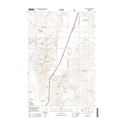
2014 Map of Elk Park Pass
USGS Topo · Published 2014About this map
Elk Park Pass serves as a critical geographic transition where the highlands meet the industrial outskirts of Butte, Montana. This landscape is defined by the crossing of the Continental Divide and the rugged drainages of Woodville Canyon and Horse Canyon. To the northeast, the rural settlements of Trask and Woodville sit along the corridor of Bison Cr, while the southwestern corner of the map reveals the urban and industrial edges of the Butte area.
Find a feature on this map
45 named features on this map. Tap any name to fly to it.
Don’t see what you’re looking for? This feature index may not catch every label — zoom into the map to look around manually.
Map Details
Editions of this 2014 Elk Park Pass Map
This is the sole edition of this map. No revisions or reprints were ever made.
Other maps of this area

1889 · Helena
USGS Topo · 1:250,000

1893 · Helena
USGS Topo · 1:250,000

1893 · Dillon
USGS Topo · 1:250,000

1899 · Boulder
USGS Topo · 1:125,000

1899 · Helena
USGS Topo · 1:250,000

1903 · Helena
USGS Topo · 1:250,000

1947 · Butte
USGS Topo · 1:250,000

1954 · Elk Park
USGS Topo · 1:62,500

1955 · Dillon
USGS Topo · 1:250,000

1957 · Dillon
USGS Topo · 1:250,000