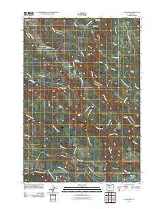
2011 Map of Elk Prairie
USGS Topo · Published 2011About this map
Holy Rosary Cemetery sits in the northwest corner of this quadrangle, serving as a quiet waypoint in an area defined by deep river basins and mountain creeks. This 2011 survey illustrates the complex drainage network of the Cascades foothills, where Abiqua Creek and Butte Creek carve through the landscape. The map highlights several significant natural features, including Abiqua Falls and the southern Abiqua Basin, which provide clear markers for those studying the area's hydrology and land use.
Find a feature on this map
51 named features on this map. Tap any name to fly to it.
Don’t see what you’re looking for? This feature index may not catch every label — zoom into the map to look around manually.
Map Details
Editions of this 2011 Elk Prairie Map
This is the sole edition of this map. No revisions or reprints were ever made.
Other maps of this area

1916 · Estacada
USGS Topo · 1:125,000

1929 · Mill City
USGS Topo · 1:125,000

1939 · Molalla
USGS Topo · 1:62,500

1940 · Molalla
USGS Topo · 1:62,500

1948 · Vancouver
USGS Topo · 1:250,000

1950 · Vancouver
USGS Topo · 1:250,000

1950 · Vancouver
USGS Topo · 1:250,000

1951 · Lyons
USGS Topo · 1:62,500

1953 · Salem
USGS Topo · 1:250,000

1954 · Salem
USGS Topo · 1:250,000