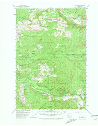
1953 Map of Elk Rock
USGS Topo · Published 1981About this map
Cowlitz River and its southern tributaries define this 1952 topographic study of the foothills in Lewis and Cowlitz counties. The landscape is marked by the infrastructure of the timber industry, with several established outposts including Camp 9, Camp 10, and Camp Baker connected by a widespread Logging Railroad network. These rail lines wind through the drainages of Green River and Devils Creek, providing a look at mid-century mountain transport before many of these routes were replaced by forest roads.
Find a feature on this map
39 named features on this map. Tap any name to fly to it.
Don’t see what you’re looking for? This feature index may not catch every label — zoom into the map to look around manually.
Map Details
Editions of this 1953 Elk Rock Map

Other maps of this area

1916 · Chehalis
USGS Topo · 1:125,000

1919 · Mount St Helens
USGS Topo · 1:125,000

1937 · Eatonville
USGS Topo · 1:125,000

1942 · Toutle
USGS Topo · 1:62,500

1943 · Willapa
USGS Topo · 1:62,500

1943 · Pigeon Springs
USGS Topo · 1:62,500

1953 · Hoquiam
USGS Topo · 1:250,000

1953 · Toutle
USGS Topo · 1:62,500

1953 · Pigeon Springs
USGS Topo · 1:62,500

1953 · Cougar
USGS Topo · 1:62,500