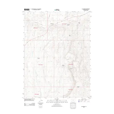
2013 Map of Elk Springs
USGS Topo · Published 2013About this map
Elk Springs serves as the central hub of this Moffat County region, as it appeared in the early 1980s. The landscape is characterized by a complex network of arid-region drainages, most notably East Fork Wolf Creek and Coal Creek. These waterways have helped shape the local geography, creating distinctive features like Winter Valley and the winding Winter Valley Gulch. High points such as Pinyon Ridge overlook the surrounding terrain, including Buffalo Gulch and McAndrews Gulch. The road network is anchored by Us-40 E, with gravel and dirt routes such as Deer Valley Rd and Bear Valley Rd branching out into the backcountry. For researchers of Northwest Colorado, this document reveals the placement of rural infrastructure and natural landmarks before decades of subsequent environmental change.
Find a feature on this map
22 named features on this map. Tap any name to fly to it.
Don’t see what you’re looking for? This feature index may not catch every label — zoom into the map to look around manually.
Map Details
Editions of this 2013 Elk Springs Map
This is the sole edition of this map. No revisions or reprints were ever made.
Other maps of this area

1907 · Rangely
USGS Topo · 1:125,000

1907 · White River
USGS Topo · 1:125,000

1910 · White River
USGS Topo · 1:125,000

1910 · Rangely
USGS Topo · 1:125,000

1954 · Vernal
USGS Topo · 1:250,000

1958 · Vernal
USGS Topo · 1:250,000

1960 · Vernal
USGS Topo · 1:250,000

1960 · Elk Springs
USGS Topo · 1:62,500
1962 · Divide Creek
USGS Topo · 1:24,000
1962 · M F Mountain
USGS Topo · 1:24,000