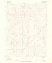
1962 Map of M F Mountain
USGS Topo · Published 1965About this map
M F Mountain dominates this portion of Moffat County, overlooking a landscape defined by cattle ranching and water management in the early 1960s. The map reveals a network of high-desert infrastructure, including several named ranching sites like the Bar 71 Ranch and family-named landmarks such as the Bailey Place and Wolf Place. Water, the region's most precious resource, is tracked through an extensive system of catchment basins including Mancos Reservoir No 2, Baking Powder Reservoir, and the Wolf Creek Reservoir No 2.
Find a feature on this map
36 named features on this map. Tap any name to fly to it.
Don’t see what you’re looking for? This feature index may not catch every label — zoom into the map to look around manually.
Map Details
Editions of this 1962 M F Mountain Map
3 editions found
Other maps of this area

1907 · Rangely
USGS Topo · 1:125,000

1907 · White River
USGS Topo · 1:125,000

1910 · White River
USGS Topo · 1:125,000

1910 · Rangely
USGS Topo · 1:125,000

1954 · Vernal
USGS Topo · 1:250,000

1958 · Vernal
USGS Topo · 1:250,000

1960 · Vernal
USGS Topo · 1:250,000

1960 · Elk Springs
USGS Topo · 1:62,500

1962 · Cactus Reservoir
USGS Topo · 1:24,000
1962 · Divide Creek
USGS Topo · 1:24,000