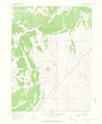
1962 Map of M F Mountain
USGS Topo · Published 1965About this map
M F Mountain anchors this high-desert landscape in northwestern Colorado, where the 1960s terrain is defined by a complex network of seasonal watercourses and local landmarks. The map documents an era of ranching and land use, evidenced by the presence of family-named sites such as Carver Cabin, Bailey Place, and Mobley Place. These small settlements and structures are scattered across a landscape carved by Wolf Creek, Disappointment Draw, and Yellow Cat Draw, illustrating the vital importance of water management in this arid region.
Find a feature on this map
31 named features on this map. Tap any name to fly to it.
Don’t see what you’re looking for? This feature index may not catch every label — zoom into the map to look around manually.
Map Details
Editions of this 1962 M F Mountain Map
3 editions found
Other maps of this area

1907 · Rangely
USGS Topo · 1:125,000

1907 · White River
USGS Topo · 1:125,000

1910 · White River
USGS Topo · 1:125,000

1910 · Rangely
USGS Topo · 1:125,000

1954 · Vernal
USGS Topo · 1:250,000

1958 · Vernal
USGS Topo · 1:250,000

1960 · Vernal
USGS Topo · 1:250,000

1960 · Elk Springs
USGS Topo · 1:62,500

1962 · Cactus Reservoir
USGS Topo · 1:24,000
1962 · Divide Creek
USGS Topo · 1:24,000