
1962 Map of Cactus Reservoir
USGS Topo · Published 1965About this map
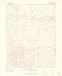
The White River valley south of Coal Ridge reveals a landscape defined by water management and mineral extraction in the early 1960s. This arid stretch along the Moffat and Rio Blanco County line is networked with vital reservoirs, including Cactus Reservoir, Darwin Reservoir, and the Box Elder Reservoir series, reflecting the necessity of irrigation and livestock watering in the high desert. The presence of the Staley-Gordon Mine near the riverbank points to the region's industrial ties, while a lone Footbridge over the main channel indicates localized crossings in an area otherwise reliant on a Jeep Trail and Pack Trail network. Notable terrain features like Hatch Flats and drainage systems such as Skull Creek and Red Wash illustrate the complex topography that early ranchers and miners navigated.
Find a feature on this map
30 named features on this map. Tap any name to fly to it.
Don’t see what you’re looking for? This feature index may not catch every label — zoom into the map to look around manually.
Map Details
Editions of this 1962 Cactus Reservoir Map
2 editions found
Other maps of this area

1907 · Rangely
USGS Topo · 1:125,000

1910 · Rangely
USGS Topo · 1:125,000

1954 · Vernal
USGS Topo · 1:250,000

1958 · Vernal
USGS Topo · 1:250,000

1960 · Vernal
USGS Topo · 1:250,000

1962 · Lazy Y Point
USGS Topo · 1:24,000

1962 · Rangely NE
USGS Topo · 1:24,000
1962 · Rangely
USGS Topo · 1:24,000
1962 · Calamity Ridge
USGS Topo · 1:24,000
1962 · Gillam Draw
USGS Topo · 1:24,000