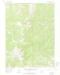
1962 Map of Calamity Ridge
USGS Topo · Published 1965About this map
Calamity Ridge dominates the center of this 1962 landscape, a complex drainage network where the North Fork and Middle Fork meet. The map reveals a land utilized for seasonal grazing and hunting, marked by several remote outposts including Hogner Cabin, Beard Cabin, and Caldwell Camp. These named structures, along with the Kenney Camp to the south, provide valuable coordinates for local historians tracing early 20th-century land use in Rio Blanco County.
Find a feature on this map
40 named features on this map. Tap any name to fly to it.
Don’t see what you’re looking for? This feature index may not catch every label — zoom into the map to look around manually.
Map Details
Editions of this 1962 Calamity Ridge Map
2 editions found
Other maps of this area

1907 · Rangely
USGS Topo · 1:125,000

1907 · White River
USGS Topo · 1:125,000

1910 · White River
USGS Topo · 1:125,000

1910 · Rangely
USGS Topo · 1:125,000

1952 · Wolf Ridge
USGS Topo · 1:24,000

1954 · Vernal
USGS Topo · 1:250,000

1956 · Grand Junction
USGS Topo · 1:250,000

1958 · Vernal
USGS Topo · 1:250,000

1959 · Grand Junction
USGS Topo · 1:250,000

1960 · Vernal
USGS Topo · 1:250,000