
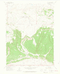
1962 Map of Lazy Y Point
USGS Topo · Published 1965About this map
Lazy Y Summer Camp and Ramsey Summer Camp occupy the high country of Moffat County in this early 1960s survey, illustrating the area's mid-century recreational character. The terrain is defined by a series of prominent elevations and water sources, from the peak of Moose Head Mountain to the namesake Lazy Y Point. The landscape is etched by seasonal drainage patterns like Red Wash and Stinking Water Creek, while water management is evident through infrastructure like Skyline Res No 2 and Skyline Res No 3. Notable landmarks such as Arapahoe Rock and Martin Gap serve as essential navigational markers across the high-altitude plateaus. The presence of several Drill Holes and remote Flowing Wells points to the area's resource exploration and ranching history in the years following World War II.
Find a feature on this map
29 named features on this map. Tap any name to fly to it.
Don’t see what you’re looking for? This feature index may not catch every label — zoom into the map to look around manually.
Map Details
Editions of this 1962 Lazy Y Point Map
4 editions found
Other maps of this area

1907 · Rangely
USGS Topo · 1:125,000

1910 · Rangely
USGS Topo · 1:125,000

1954 · Hells Canyon
USGS Topo · 1:24,000

1954 · Vernal
USGS Topo · 1:250,000

1958 · Vernal
USGS Topo · 1:250,000

1960 · Vernal
USGS Topo · 1:250,000

1962 · Tanks Peak
USGS Topo · 1:24,000

1962 · Rangely NE
USGS Topo · 1:24,000

1962 · Cactus Reservoir
USGS Topo · 1:24,000
1962 · Mellen Hill
USGS Topo · 1:24,000