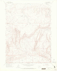
1962 Map of Lazy Y Point
USGS Topo · Published 1972About this map
Lazy Y Summer Camp serves as a lone human footprint in this high-altitude landscape of northwest Colorado, situated near the dramatic drop-offs of Lazy Y Point. The terrain is characterized by a series of deep drainages including Box Canyon and Long Draw, which channel seasonal water toward the southern expanse of Red Wash. This 1962 survey reveals how water management was critical even in this sparsely populated area, evidenced by the presence of Skyline Res No 3 and Skyline Res No 2 near the base of Blue Mountain.
Find a feature on this map
19 named features on this map. Tap any name to fly to it.
Don’t see what you’re looking for? This feature index may not catch every label — zoom into the map to look around manually.
Map Details
Editions of this 1962 Lazy Y Point Map
4 editions found
Other maps of this area

1907 · Rangely
USGS Topo · 1:125,000

1910 · Rangely
USGS Topo · 1:125,000

1954 · Hells Canyon
USGS Topo · 1:24,000

1954 · Vernal
USGS Topo · 1:250,000

1958 · Vernal
USGS Topo · 1:250,000

1960 · Vernal
USGS Topo · 1:250,000

1962 · Lazy Y Point
USGS Topo · 1:24,000

1962 · Tanks Peak
USGS Topo · 1:24,000

1962 · Rangely NE
USGS Topo · 1:24,000

1962 · Cactus Reservoir
USGS Topo · 1:24,000