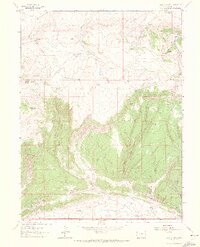
1962 Map of Lazy Y Point
USGS Topo · Published 1972About this map
Moose Head Mountain and the high ridges of Lazy Point dominate this high-desert landscape in northwestern Colorado. The 1962 terrain reveals a network of seasonal water sources and springs vital to the area's summer residency, including Lazy Y Summer Camp and Ramsey Summer Camp. High peaks like Arapahoe Rock overlook deep incisions such as Box Canyon and the winding course of Wolf Creek.
Find a feature on this map
24 named features on this map. Tap any name to fly to it.
Don’t see what you’re looking for? This feature index may not catch every label — zoom into the map to look around manually.
Map Details
Editions of this 1962 Lazy Y Point Map
4 editions found
Other maps of this area

1907 · Rangely
USGS Topo · 1:125,000

1910 · Rangely
USGS Topo · 1:125,000

1954 · Hells Canyon
USGS Topo · 1:24,000

1954 · Vernal
USGS Topo · 1:250,000

1958 · Vernal
USGS Topo · 1:250,000

1960 · Vernal
USGS Topo · 1:250,000

1962 · Lazy Y Point
USGS Topo · 1:24,000

1962 · Tanks Peak
USGS Topo · 1:24,000

1962 · Rangely NE
USGS Topo · 1:24,000

1962 · Cactus Reservoir
USGS Topo · 1:24,000