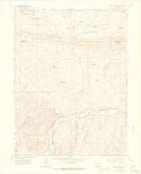
1962 Map of Cactus Reservoir
USGS Topo · Published 1965About this map
The White River carves a winding path across this Colorado landscape, defining the southern valley where industrial and agricultural water management systems converge. A network of small-scale infrastructure, including Coal Ridge Dam and Raven Park Dam, highlights the effort to capture water in a region marked by extensive draws and gulches like Fletcher Gulch and Scullion Gulch. Evidence of early resource extraction is found at the Staley Gordon Mine, while transportation is limited to a Jeep Trail and Pack Trail that navigate the high ground of Coal Ridge. Remote landmarks such as a lone Grave and the Jones Tunnel near the Rock Wall suggest a history of isolated prospecting and grazing. The map documents a period before modern development, where numerous numbered reservoirs like Box Elder Reservoir No 2 supported livestock across the Hatch Flats.
Find a feature on this map
30 named features on this map. Tap any name to fly to it.
Don’t see what you’re looking for? This feature index may not catch every label — zoom into the map to look around manually.
Map Details
Editions of this 1962 Cactus Reservoir Map
2 editions found
Other maps of this area

1907 · Rangely
USGS Topo · 1:125,000

1910 · Rangely
USGS Topo · 1:125,000

1954 · Vernal
USGS Topo · 1:250,000

1958 · Vernal
USGS Topo · 1:250,000

1960 · Vernal
USGS Topo · 1:250,000

1962 · Lazy Y Point
USGS Topo · 1:24,000

1962 · Rangely NE
USGS Topo · 1:24,000
1962 · Rangely
USGS Topo · 1:24,000

1962 · Cactus Reservoir
USGS Topo · 1:24,000
1962 · Calamity Ridge
USGS Topo · 1:24,000