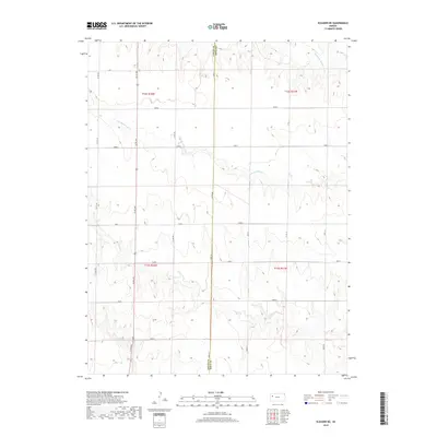
2018 Map of Elkader NE
USGS Topo · Published 2018About this map
The Logan Co Gove Co boundary divides this High Plains landscape, where the drainage patterns of the Hackberry Creek system dominate the topography. The northern portion of the map is defined by the winding course of Middle Br Hackberry Cr and S Br Hackberry Cr, while Plum Cr cuts through the southern sections. This area of western Kansas is organized into distinct land divisions with names such as Topeka, Seneca, Navajo, and Osage, reflecting a systematic approach to rural land management. A network of local roads, including Co Rd 440 and Gove 10, provides the primary infrastructure through the rolling terrain between Quail and Plains. The map captures the intersection of natural watercourses and the rigid grid of the Public Land Survey System in a sparsely settled agricultural region.
Find a feature on this map
28 named features on this map. Tap any name to fly to it.
Don’t see what you’re looking for? This feature index may not catch every label — zoom into the map to look around manually.
Map Details
Editions of this 2018 Elkader NE Map
This is the sole edition of this map. No revisions or reprints were ever made.
Other maps of this area

1954 · Goodland
USGS Topo · 1:250,000

1955 · Scott City
USGS Topo · 1:250,000

1956 · Goodland
USGS Topo · 1:250,000

1957 · Goodland
USGS Topo · 1:250,000

1958 · Scott City
USGS Topo · 1:250,000

1972 · Elkader NW
USGS Topo · 1:24,000

1972 · Orion
USGS Topo · 1:24,000

1972 · Elkader NE
USGS Topo · 1:24,000

1974 · Elkader SW
USGS Topo · 1:24,000

1974 · Elkader
USGS Topo · 1:24,000