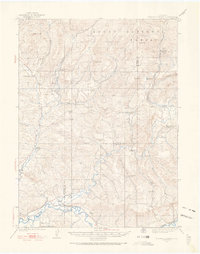
1923 Map of Elkhead Creek
USGS Topo · Published 1966About this map
The Yampa River corridor in northwest Colorado defined a landscape of remote mountain ranching and early coal extraction at the time of this 1923 survey. Small, localized settlements such as Elkhead and Mesa Rica served as focal points for a rural population supported by an extensive network of country schools, including Upper Elkhead School, Dry Fork School, and Cottonwood School. This dense distribution of one-room schoolhouses implies a distributed ranching community where travel was dictated by the winding gulches and creek beds.
Find a feature on this map
41 named features on this map. Tap any name to fly to it.
Don’t see what you’re looking for? This feature index may not catch every label — zoom into the map to look around manually.
Map Details
Editions of this 1923 Elkhead Creek Map
5 editions found
Other maps of this area

1910 · Danforth Hills
USGS Topo · 1:125,000

1915 · Monument Butte
USGS Topo · 1:62,500

1916 · Craig
USGS Topo · 1:125,000

1916 · Daton Peak
USGS Topo · 1:62,500

1920 · Daton Peak
USGS Topo · 1:62,500

1923 · Elkhead Creek
USGS Topo · 1:62,500

1923 · Pilot Knob
USGS Topo · 1:62,500

1924 · Elkhead Creek
USGS Topo · 1:62,500

1924 · Mt. Harris
USGS Topo · 1:48,000

1925 · Pilot Knob
USGS Topo · 1:62,500