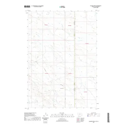
2020 Map of Elkhorn Creek SE
USGS Topo · Published 2020About this map
The Montana-South Dakota border bisects this landscape, marking the intersection of Carter and Butte counties. The terrain is defined by a dense network of intermittent drainage channels, where S Indian Cr and Frozen Horse Cr carve paths through the high plains. Human activity is sparse, concentrated along a few key thoroughfares such as Albion Rd and Indian Creek Rd that provide access to the remote survey sections. The map reveals the intricate public land survey system, with townships and ranges including t8s r62e and t13n r1e meeting at the state line. Landforms like Watson Draw and watercourses such as Bean Blossom Cr characterize the arid environment of this borderland region in the early twenty-first century.
Find a feature on this map
16 named features on this map. Tap any name to fly to it.
Don’t see what you’re looking for? This feature index may not catch every label — zoom into the map to look around manually.
Map Details
Editions of this 2020 Elkhorn Creek SE Map
This is the sole edition of this map. No revisions or reprints were ever made.
Other maps of this area

1901 · Aladdin
USGS Topo · 1:125,000

1903 · Aladdin
USGS Topo · 1:125,000

1905 · Indian
USGS Topo · 1:62,500

1907 · Belle Fourche
USGS Topo · 1:125,000

1935 · Harding
USGS Topo · 1:125,000

1953 · Rapid City
USGS Topo · 1:250,000

1954 · Lemmon
USGS Topo · 1:250,000

1954 · Ekalaka
USGS Topo · 1:250,000

1954 · Gillette
USGS Topo · 1:250,000

1955 · Gillette
USGS Topo · 1:250,000