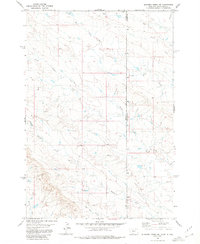
1980 Map of Elkhorn Creek SE
USGS Topo · Published 1980About this map
Frozen Horse Creek and South Indian Creek dominate this high plains landscape at the border of Montana and South Dakota. Surveyed by the U.S. Geological Survey using aerial photography from 1972 and field-checked in 1974, the map documents a transition between Carter and Butte Counties. The topography is defined by intricate drainages such as Watson Draw and Lone Tree Creek, illustrating the complex erosional patterns typical of the region. Notable landmarks like Easter Creek and Bear Blossom Cr provide essential navigational points in this sparsely populated territory. The Black Hills Meridian runs through the center of the sheet, marking a significant cartographic boundary between state lines during the late twentieth century.
Find a feature on this map
10 named features on this map. Tap any name to fly to it.
Don’t see what you’re looking for? This feature index may not catch every label — zoom into the map to look around manually.
Map Details
Editions of this 1980 Elkhorn Creek SE Map
This is the sole edition of this map. No revisions or reprints were ever made.
Other maps of this area

1901 · Aladdin
USGS Topo · 1:125,000

1903 · Aladdin
USGS Topo · 1:125,000

1905 · Indian
USGS Topo · 1:62,500

1907 · Belle Fourche
USGS Topo · 1:125,000

1935 · Harding
USGS Topo · 1:125,000

1953 · Rapid City
USGS Topo · 1:250,000

1954 · Lemmon
USGS Topo · 1:250,000

1954 · Ekalaka
USGS Topo · 1:250,000

1954 · Gillette
USGS Topo · 1:250,000

1955 · Gillette
USGS Topo · 1:250,000