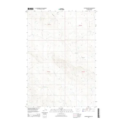
2014 Map of Elkhorn Creek SW
USGS Topo · Published 2014About this map
Watson Draw and its complex network of drainage basins define this portion of Carter County, Montana. The landscape is carved by numerous seasonal waterways, including the prominent Owl Cr and S Indian Cr, which illustrate the natural erosion patterns of the northern Great Plains. These creek beds serve as the primary topographical markers in an area otherwise characterized by its remote, open terrain. Human infrastructure is notably sparse, consisting primarily of section lines and a few isolated routes like Indian Creek Rd and Courtney Ln. The survey reflects the enduring cattle ranching and agricultural grid of the early 21st century, with land partitioned according to the Public Land Survey System as seen in the designations for t8s r61e and t9s r62e. Geologists and researchers can trace the specific flow of Twelvemile Cr and Ninemile Cr through the northwest corner of the quadrangle.
Find a feature on this map
15 named features on this map. Tap any name to fly to it.
Don’t see what you’re looking for? This feature index may not catch every label — zoom into the map to look around manually.
Map Details
Editions of this 2014 Elkhorn Creek SW Map
This is the sole edition of this map. No revisions or reprints were ever made.
Other maps of this area

1901 · Aladdin
USGS Topo · 1:125,000

1903 · Aladdin
USGS Topo · 1:125,000

1954 · Ekalaka
USGS Topo · 1:250,000

1954 · Gillette
USGS Topo · 1:250,000

1955 · Gillette
USGS Topo · 1:250,000

1956 · Ekalaka
USGS Topo · 1:250,000

1957 · Mona
USGS Topo · 1:62,500

1957 · Colony
USGS Topo · 1:62,500

1958 · Gillette
USGS Topo · 1:250,000

1958 · Ekalaka
USGS Topo · 1:250,000